Caves of Mawmluh & Mawsmai
Did you know that our Earth is currently in a geological time period called the Meghalayan Age? This age was named after the stalagmite formations found in the Mawmluh cave that carry marks of a severe drought around 2000 BC. Some earth scientists believe that this drought may have contributed to the decline of the Harappan civilization and other Bronze Age civilizations. This research was carried out by the team led by Jessica Oster, assistant professor of earth and environmental sciences at Vanderbilt University.
Isn't it fascinating that a cave in Meghalaya can reveal so much about the past of our Earth? This was one of the first unique references to Meghalaya that I stumbled upon, which led me to dig deeper and learn more about Khasi culture, ultimately inspiring me to plan this trip.
Meghalaya: An Island?
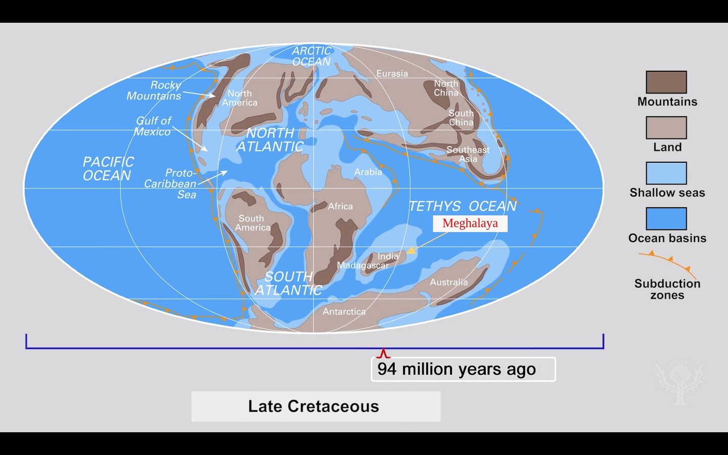 The period when Meghalaya was a shallow seabed.
Meghalaya was actually an island around 3 billion years ago, located near the African continent in the Gondwanaland supercontinent. This was before the continental drift, which began around 88 million years ago when the Indian subcontinent broke away from Australia and Africa and started moving northward.
During this period, Meghalaya was a thriving coral island teeming with marine life. Due to this, we can observe a high number of limestone deposits (formed by marine sedimentation), including those found in the caves. However, due to continental drift and tectonic movements, the sea bed was uplifted to considerable heights, resulting in the mountain ranges we see today surrounding Meghalaya, including Khasi, Garo, and Jaintia Hills.
Caves in Meghalaya
Meghalaya boasts the highest number of caves in India, among which is the longest one called the Krem Liat Prah limestone cave system. The unique combination of limestone, heavy rainfall, and high elevation has resulted in the formation of world's largest and longest limestone cave network system here.
As of now, more than 1,700 caves have been identified in Meghalaya, with most of them being limestone or sandstone formations. Out of these, I had the opportunity to explore the Mawsmai cave.
Mawsmai Cave Sohra
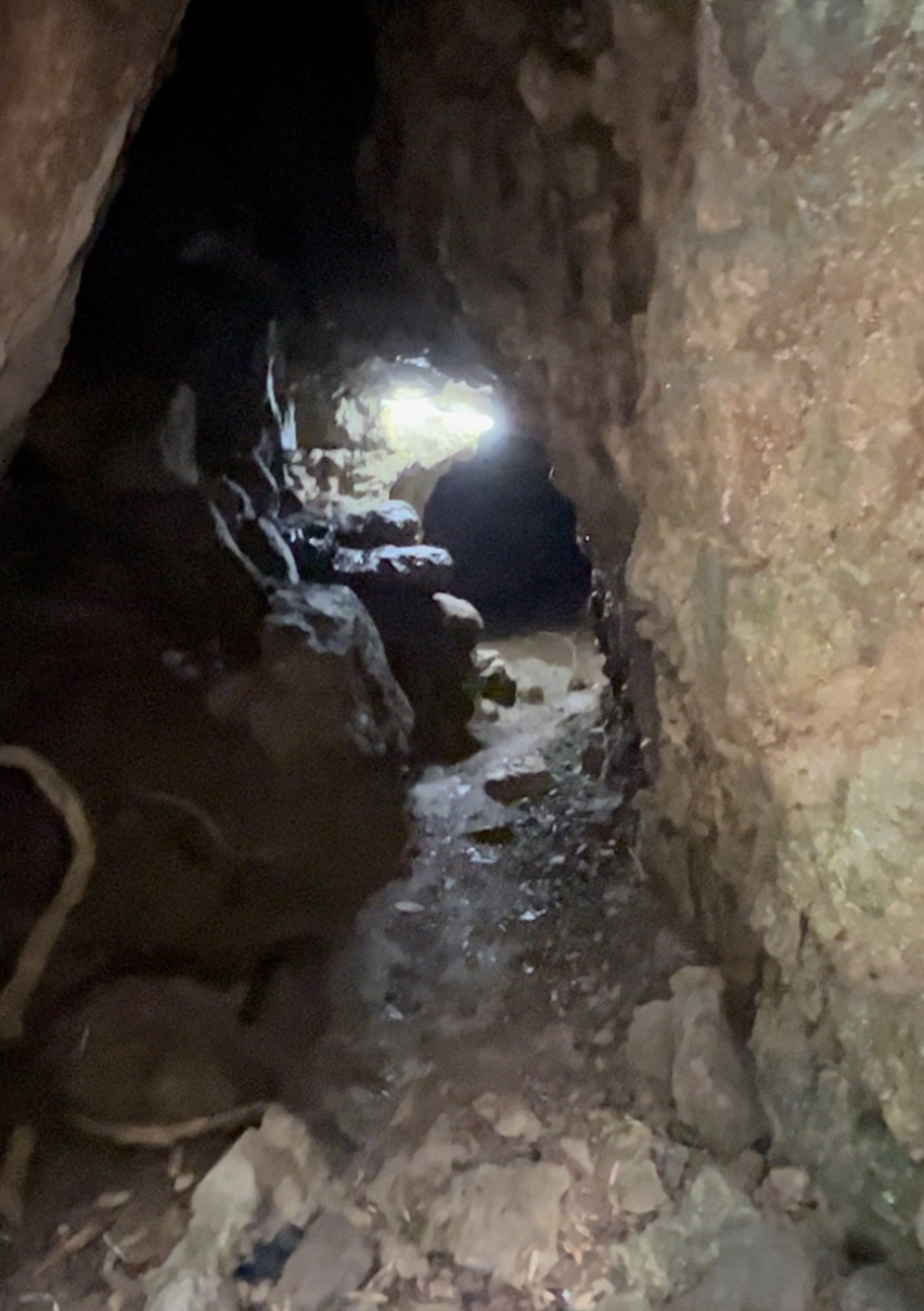 Entrance to Mawsmai Cave.
Picture credit: @aryan
Mawsmai Cave is one of the few caves open to the general public, and I chose it specifically because of the ample natural sunlight inside which allows for clear viewing of the limestone deposition and formation. Although the cave is quite lengthy, only a 150-meter section is open for tourists while the remaining part is closed due to its complex network of passages, where visitors can easily get lost. Pass to it is very easy, with over few narrow passes.
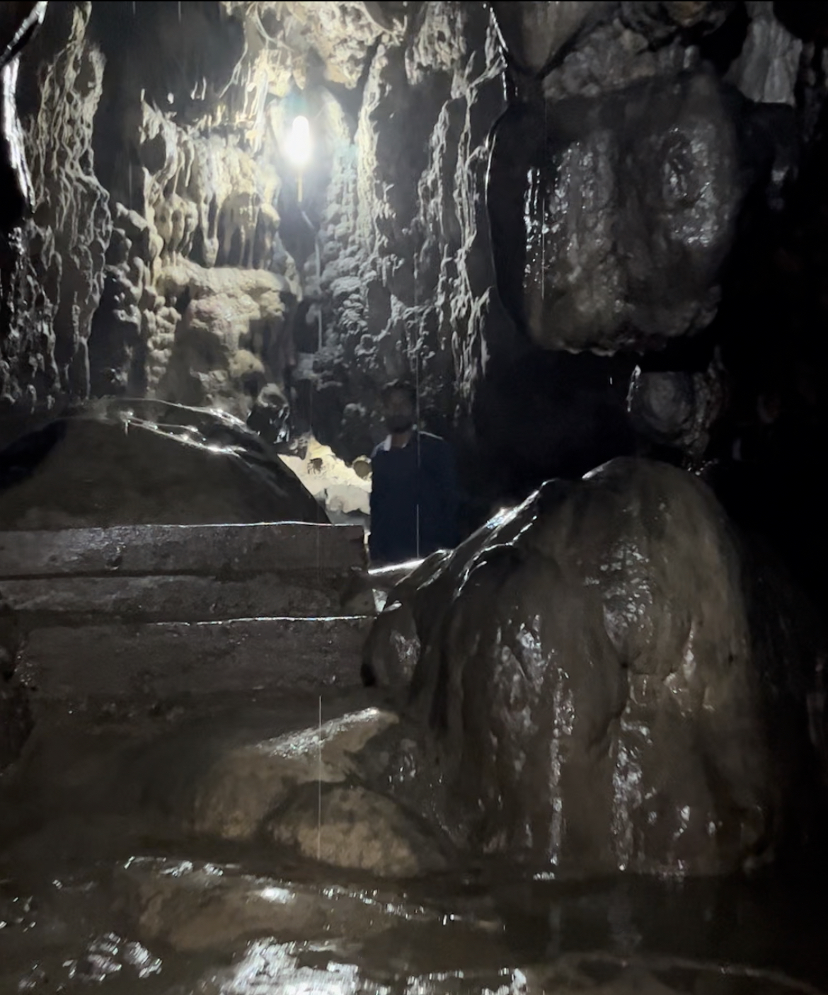 Constant dripping of water from the cave's roof, with stalagmites formation.
As visitors venture deeper into the cave, they can witness a constant dripping of water from the cave's roof, along with numerous forms of stalactites and stalagmites. Here, stalagmites take on various shapes and sizes over thousands of years, such as that of ice-cream cones, making it interesting to observe. The cave is also home to a variety of wildlife, including bats and swiftlets.
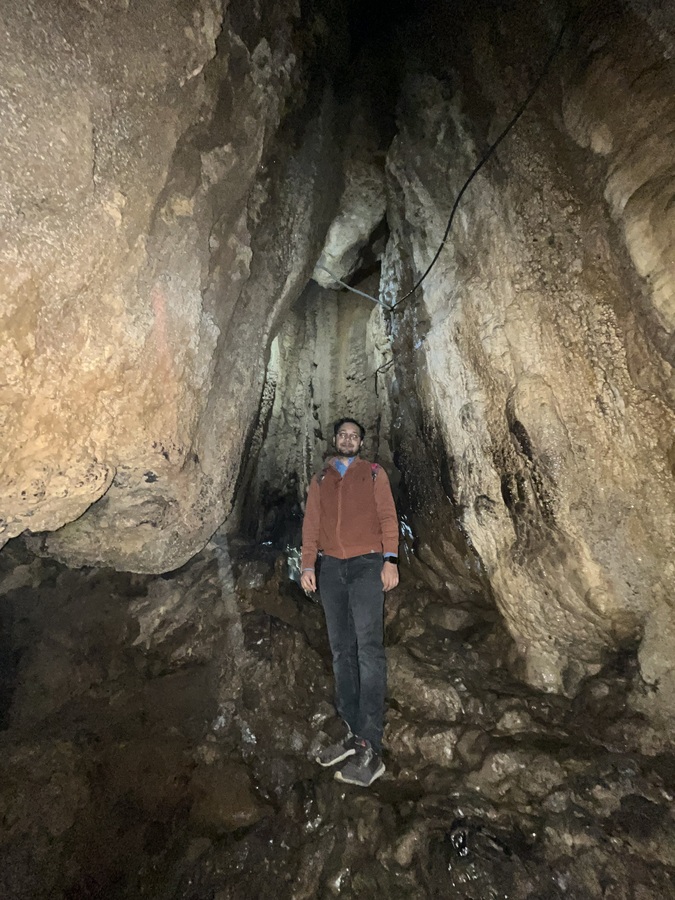 Here I am at the end of the cave, surrounded by the depositions of sea life all around.
Picture credit: @aryan
What fascinated me the most was these caves which were once a sea bed millions of years ago, where marine life would thrive in abundance. Now, they are filled with beautiful, hollow limestone stalagmite formations, a geographical wonder.